Difference between revisions of "Maps"
From Carrick-Overbrook Historical Society
| Line 2: | Line 2: | ||
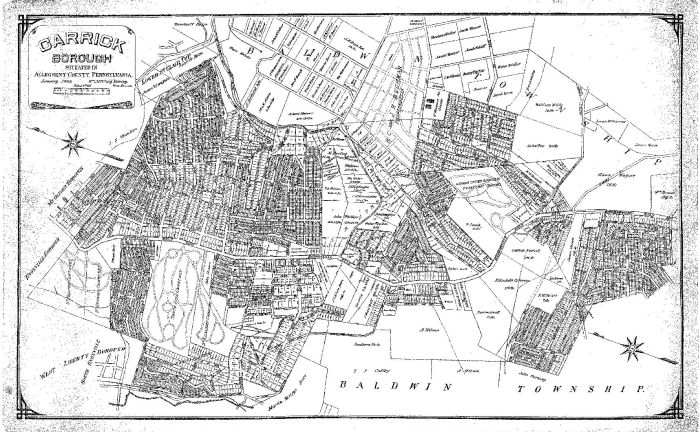
| − | == This 1905 Carrick Borough map is now framed and hanging on the "Carrick Room" of the Carrick Branch of the Carnegie Library of Pittsburgh. See [Pittsburgh Leader 1904]for the full story of Carrick Borough breaking away from Baldwin Township on [June 21, 1904]. == | + | == This 1905 Carrick Borough map is now framed and hanging on the "Carrick Room" of the Carrick Branch of the Carnegie Library of Pittsburgh. See [[Pittsburgh Leader 1904]] for the full story of Carrick Borough breaking away from Baldwin Township on [[June 21, 1904]]. == |
[[Image:1905 carrick map.JPG]] | [[Image:1905 carrick map.JPG]] | ||
Revision as of 19:10, 13 November 2008
This section contains a collection of maps of Carrick.
This 1905 Carrick Borough map is now framed and hanging on the "Carrick Room" of the Carrick Branch of the Carnegie Library of Pittsburgh. See Pittsburgh Leader 1904 for the full story of Carrick Borough breaking away from Baldwin Township on June 21, 1904.

