Difference between revisions of "Photos of our Beautiful Neighborhood"
From Carrick-Overbrook Historical Society
(New page: == Post your favorite photos of our beautiful neighborhood here. == Our neighborhood looking east from the South Side Cemetery. St. Adalbert's Cemetery is below with St. Basil's Church S...) |
|||
| (3 intermediate revisions by the same user not shown) | |||
| Line 1: | Line 1: | ||
| + | == Post your recent favorite photos of our beautiful neighborhood here. In 50 years these too will be historic.== | ||
| − | |||
| − | Our neighborhood looking east from the South Side Cemetery. St. Adalbert's Cemetery is below with St. Basil's Church Steeples in the distance. Photo taken January 3, 2009. | + | == Our neighborhood looking east from the South Side Cemetery. St. Adalbert's Cemetery is below with St. Basil's Church Steeples in the distance. Photo taken January 3, 2009. == |
[[Image:Carrick 2008 from ss cemetery.jpg]] | [[Image:Carrick 2008 from ss cemetery.jpg]] | ||
| − | Our neighborhood looking west from St. Basil's Elementary School on Concordia Street. Photo taken early 2008. | + | |
| + | == Our neighborhood looking west from St. Basil's Elementary School on Concordia Street. Photo taken early 2008. == | ||
[[Image:Carrick 2008 from Concordia st.jpg]] | [[Image:Carrick 2008 from Concordia st.jpg]] | ||
| + | |||
| + | |||
| + | == Brownsville Road looking south at Churchview Avenue. Photo taken early 2008. For more photos of this area see [[Lennix Gulf Station]].== | ||
| + | |||
| + | [[Image:Brownsville road heading south 2008.jpg]] | ||
| + | |||
| + | |||
| + | == Brownsville Road looking north at Churchview Avenue. Photo taken early 2008. For more photos of this area see [[Lennix Gulf Station]].== | ||
| + | |||
| + | [[Image:Brownsville road heading north 2008.jpg]] | ||
| + | |||
| + | |||
| + | == 2336 Brownsville Road December 2008. For more photos of this location see [[Impton]]. == | ||
| + | |||
| + | [[Image:Impton 2008.jpg]] | ||
| + | |||
| + | |||
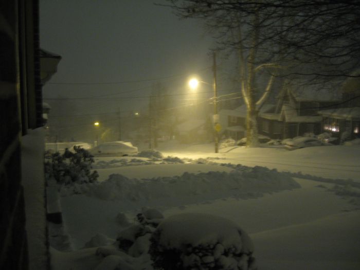
| + | == 200 Block Hornaday Road, Snowfall night February 5, 2010 9:30 PM == | ||
| + | |||
| + | [[Image:February 5, 2010 hornaday 2130 pm.jpg]] | ||
| + | |||
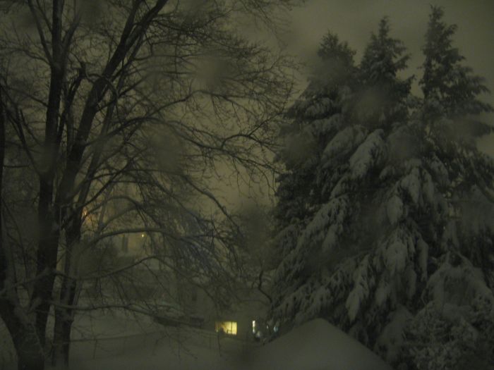
| + | == Back of 219 Hornaday, Snowfall night February 5, 2010 9:30 PM == | ||
| + | |||
| + | [[Image:February 5, 2010 back 4 2130pm.jpg]] | ||
Latest revision as of 18:54, 5 February 2010
Contents
- 1 Post your recent favorite photos of our beautiful neighborhood here. In 50 years these too will be historic.
- 2 Our neighborhood looking east from the South Side Cemetery. St. Adalbert's Cemetery is below with St. Basil's Church Steeples in the distance. Photo taken January 3, 2009.
- 3 Our neighborhood looking west from St. Basil's Elementary School on Concordia Street. Photo taken early 2008.
- 4 Brownsville Road looking south at Churchview Avenue. Photo taken early 2008. For more photos of this area see Lennix Gulf Station.
- 5 Brownsville Road looking north at Churchview Avenue. Photo taken early 2008. For more photos of this area see Lennix Gulf Station.
- 6 2336 Brownsville Road December 2008. For more photos of this location see Impton.
- 7 200 Block Hornaday Road, Snowfall night February 5, 2010 9:30 PM
- 8 Back of 219 Hornaday, Snowfall night February 5, 2010 9:30 PM
Post your recent favorite photos of our beautiful neighborhood here. In 50 years these too will be historic.
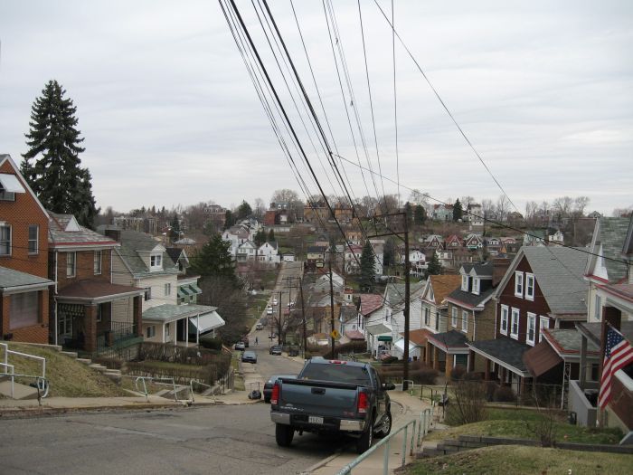
Our neighborhood looking east from the South Side Cemetery. St. Adalbert's Cemetery is below with St. Basil's Church Steeples in the distance. Photo taken January 3, 2009.
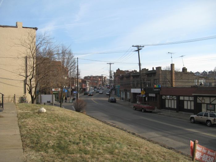
Our neighborhood looking west from St. Basil's Elementary School on Concordia Street. Photo taken early 2008.
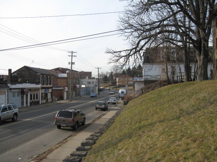
Brownsville Road looking south at Churchview Avenue. Photo taken early 2008. For more photos of this area see Lennix Gulf Station.
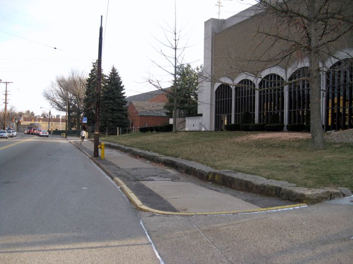
Brownsville Road looking north at Churchview Avenue. Photo taken early 2008. For more photos of this area see Lennix Gulf Station.
2336 Brownsville Road December 2008. For more photos of this location see Impton.

