Phillips Properties
Contents
- 1 The Phillips and Related Family Properties
- 2 (1 July 2006)
- 3 The Early Pittsburgh Properties
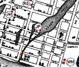
- 4 A 1795 Map of Pittsburgh (locations in red with circles)
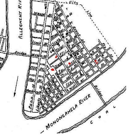
- 5 An 1826 Map of Pittsburgh (locations in red)
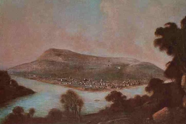
- 6 Pittsburgh in 1804
- 7 From a Painting by George Beck, English Artist (University of Pittsburgh)
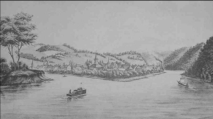
- 8 Pittsburgh in 1817
- 9 From a Sketch by Mrs. E. C. Gibson, Wife of James Gibson, Esq., of Philadelphia
- 10 The Market Place and Courthouse, circa. 1830
- 11 From a Sketch by J. P. Robitser
- 12 The Business Properties and Locations
- 13 Phillips Businesses Locations in Pittsburgh
- 14 The Lewis, Oliver and Phillips Business Locations in Birmingham
- 15 The Locations of Homes and Properties
- 16 Pittsburgh Locations for John, James and Susannah Phillips
- 17 (Wards 3 and 6 in 1827)
- 18 The Home of James (2) Phillips
- 19 St. Clair (Carrick) Properties
- 20 Early St. Clair (Carrick) Properties
- 21 Carrick – Brownsville Road Home of John Phillips
- 22 The Later Carrick Brownsville Road Properties
- 23 2336 Brownsville Road (JMP)Home of John M. Phillips
- 24 2920 Brownsville Road (RFP) Home of Robert F. Phillips
- 25 Later Carrick Properties
- 26 The Provost Properties
- 27 Provost Property on Saw Mill Run at Fairhaven
- 28 Appendix A Phillips Property Deeds
The Phillips and Related Family Properties
This information was provided by Robert F. Phillips
(1 July 2006)
There are two other papers that provide more details of the history and businesses of the Phillips family – “The Phillips Family History” and “The Phillips Business Background.” These will be listed soon.
James Phillips (elder or 1) (abt. 1786 – 27 Nov 1866) was born in Ireland and came to the United States in 1795 as a nine year old boy. There is nothing known about his family or where he lived in Pennsylvanian from 1795 until he started his business in Pittsburgh sometime before 1815 when he was listed in the business directory. He received his citizenship on 7 September 1808 in Carlisle, PA, and may have lived there for several years since he was sponsored by a George Phillips who was an editor of the local newspaper and a publisher. In order for George to vouch for him, James would have had to be in the Carlisle area for at least a year and may be longer. There is no direct relationship between George and James, but their families may have been related in Ireland. However, no records, except for his naturalization, have been found for the family of James during the period leading up to his arrival in Pittsburgh. James was educated since he could write his name and appears to have had enough money to start a business.
The Early Pittsburgh Properties
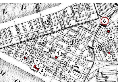
The first record of property that can be tied to James was in the 1815 Pittsburgh Business Directory. He is listed as being a “nailor” (a maker of nails) located on the north side of Fourth Street between Wood and Smithfield Streets in Pittsburgh. While this does not place him at any address it appears from the other listings he was situated close to Hogg’s Pond as shown in the figure below. It was filled in by the early-1800s.
A 1795 Map of Pittsburgh (locations in red with circles)
An 1826 Map of Pittsburgh (locations in red)
The 1795 map above shows a building existing in that location (the JP in a circle), and it probably was Lot No. 358 or 359 in Wood’s Plan of 1784. James most likely was in Pittsburgh by 1811 before the War of 1812 broke out and profited from it as did most of the Pittsburgh makers of iron and metal products. The 1820 census shows that he had married and was still located in the West Ward with his family. There is a question as to whether he was self employed or worked for one of the nail factories near by. He had some type of house on this location, and the neighbors in the census suggest that it was on Fourth Street. The house probably was a log building since most of the homes at that time were of log construction.
Three other people possibly related to James also were listed in the 1815 business directory. One was a Jane McFarland (JM in a circle), who was a merchant located on the east side of Market Street between the Diamond and Fifth Street. Her market would have been located near the Black Bear Hotel in the Diamond where the Courthouse was. She may have been the younger daughter of Baptist and Magdalena McFarlane who also were the parents of Elizabeth McFarlane, the wife of James. Since the market was in a prime location, it is likely that Baptist McFarlane established this market in the mid-1790s when he moved to the St. Clair (Baldwin) location to be able to market his farm produce in Pittsburgh. This is supported by the letters he received at the Pittsburgh Post office in 1796 and 1797. The 1796 letter was letter in care of John Irwin, store keeper, who was located on Fourth Street between Wood and Market Streets. This was between James Phillips and the McFarlane market. The market probably was first operated by Baptist, but by 1803 Isabella McFarlane who married Robert Stitt in 1807 would have been old enough to manage it. By 1807 her next older sister, who is believed to be Jane, would have been 18 and old enough to manage the market. Their younger sister, Elizabeth, could have started working in the market by 1810 when she was 18 years old. Elizabeth married James Phillips in about 1815, and by this time Baptist had moved to Mifflin (Jefferson) Township and was probably close to getting out of the produce business.
The second person near the location of James was Robert Stitt (RS in a circle), who was a carpenter. His business was located on the west side of Wood Street between Fifth Street and Virgin Alley. He married Isabella McFarlane, as noted above, and in the 1820s they moved to St. Clair Township. Their son, Montgomery Stitt, married Jane Phillips, the daughter of James and Elizabeth. The third person was a William Montgomery (WM in a circle), who was a blacksmith on the south side of Second Street above Grant Street. His home was nearby on the east side of Grant between Front and Second Streets. William was a brother to Sarah (Montgomery) Stewart. Magdalena (Montgomery) McFarlane probably was the aunt of both William and Sarah, and the mother of Isabella, Jane and Elizabeth. The McFarlane women and William Montgomery were in a position to have introduced James Phillips to Elizabeth McFarlane, as well as Robert Stitt.
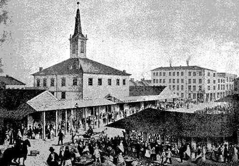
The two pictures below show the change in Pittsburgh between 1804 and 1817, the period during which James Phillips and William Montgomery located there. The building with the tall spire in these pictures was the Courthouse that was built in 1791. It was located at Market and Diamond Streets where the McFarlane market was located (see the map above) and is pictured below. Market Street ran in front of the Courthouse and the area was known as The Diamond. The horseshoe shaped stalls were for the markets; however, the McFarlane location would have been in a building since it is listed in the business directory. The stalls were temporary markets. Behind the Courthouse is the Philadelphia Store, and the McFarlane market would have been to the right of it across Market street. These buildings were occupied between 1794 and 1852 before being torn down.
Pittsburgh in 1804
From a Painting by George Beck, English Artist (University of Pittsburgh)
The 1817 picture (below) shows that Pittsburgh was still confined to the triangle between the rivers as it was in 1804. The area of Birmingham to the right of the triangle was still wooded land with a few buildings and Allegheny City to the left was much the same. However, these two areas within the next five years were to grow to sizable communities. The area along both the Monongahela and Allegheny Rivers were to become the site of many of the major factories.
The 1817 illustration shows the Courthouse (the tall building pictured below) at the Diamond near where James and Elizabeth were living in the West Ward of Pittsburgh. In 1820 they had three children and a servant living with them in addition to a woman that was probably his mother. They remained in the Pittsburgh area until 1928 when James moved their home to St. Clair Township on top of the hill across the Monongahela River.
Pittsburgh in 1817
From a Sketch by Mrs. E. C. Gibson, Wife of James Gibson, Esq., of Philadelphia
The Market Place and Courthouse, circa. 1830
From a Sketch by J. P. Robitser
The Business Properties and Locations
When James moved his home from Fourth Street (Location 1 on map above) to Baldwin, he started a blacksmith business there. There are no Phillips listed in the 1837 Business Directory for Pittsburgh (Baldwin was not included) and other information states that he had his business in Baldwin. There is a listing for a John Phillips, blacksmith, in the 1844 Pittsburgh Business Directory) on Ferry Street between Front and Water Streets, but this is a different John Phillips. John Phillips, the son of James, did his apprenticeship as a blacksmith with his father in Baldwin Township. He most likely lived at home until he got married in about 1845, since when he bought two acres in Baldwin on 22 August 1845 he stated that he lived in Baldwin. The exact location of this property has not been determined, but it appears to have been on the east side of Brownsville Road near where his father lived. After his apprenticeship with his father, he did not go into the iron business, but organized a brick construction business. John appears to have started the construction business in the late-1840s since he is listed in the 1850 census as a bricklayer. The rebuilding of Pittsburgh after the great fire in 1845 caused a demand for brick construction. John married Eliza Rossiter in about 1845, and they sold his Baldwin property on 6 April 1847. They stated that they were living in Pittsburgh at that time. The 1850 and 1860 censuses list John Phillips as a bricklayer in skilled construction living in Ward 6 of Pittsburgh. The Pittsburgh Business Directory for 1852 also lists John Phillips as a bricklayer living at 33 Prospect Street which was in Ward 6 (Location 2 below). On 10 November 1853 John bought a two story brick house at 18 Federal Street (Location 3 below) which was a short distance from the Prospect Street address. James was living with his brother John when the 1860 census was taken, and they were probably operating their construction partnership from there even though by this time John also was working in the iron business. Shortly after the 1860 census James married Ann Provost, and they moved to 31 Hazel Street nearby. (See The Locations of Homes and Properties Section). Allegheny County sued John Phillips and his two partners over some construction issue in July 1853. One partner could not pay, and so his property was sold at an auction in November 1854. The property was in the Sixth Ward, and John and the other partner bought the property for him.
It appears that James (1) in about 1849 may have began marketing iron products, such as nails and hardware, for Kittanning Iron under the name of Brown, Phillips & Co. He would have had the contacts to market these products and was probably recruited by James E. Brown who was associated with Kittanning Iron. This business continued until about 1855 when Floyd replaced the Phillips in the partnership. James would have been about 69 years old then. The Pittsburgh warehouse for Brown Phillips & Co. in 1852 was located at 99 Water Street, between Wood and Market streets in Pittsburgh (Location 4 left) near where James (1) was first located on Fourth Street. The Brown, Floyd & Co. moved a few doors down to 108 Water Street (also Location 4) which appears to have been a new building.
Phillips Businesses Locations in Pittsburgh
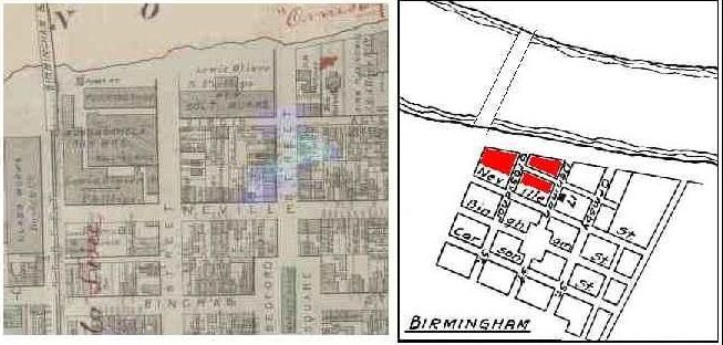
The 1857 - 1858 Business Directory for Pittsburgh lists a Phillips & Co. at 109 First Street (Location 5 above left). First Street also was known as Front Street; so the business was close to the other business locations of the Phillips family (see map above). It was identified earlier as a brass foundry owned by Long, Miller & Co. also at the same address. It appears that John bought the business about 1855, and it is first identified as the Phillips & Co. brass foundry in 1856 [“History of Pittsburg”]. The same reference also lists a Phillips & Co. in 1858 making a general line of foundry products. This may have been an outlet for the products made by the family business in Baldwin after the separation from Brown. John during this period was living at 18 Federal Street (Location 3 above) as a bricklayer in the construction business. He appears to have been in both the iron and construction business starting in the mid 1850s. By 1860 he formed a partnership with William J. Lewis, and they located the new bolt manufacturing business at the end of Liberty at the site of Union Station (Location 6 in red circle above). By 1863 they joined in partnership with Henry W. Oliver, Jr. and moved the bolt business to Birmingham under the name of Excelsior Bolt & Nut Works. It was located on land east of Grosvenor Street, and the map below shows its location in Birmingham
The 1863 partnership with Henry W. Oliver, Jr. formed the Lewis, Oliver and Phillips Company. The three of them started buying property in October 1863 located between the bolt works and the foot of the Birmingham and Pittsburgh Bridge (now the South 10th Street Bridge). By October 1866 they had acquired most, if not all, of the land bounded by the Monongahela River on the north; Grosvenor Street of the east, Neville Street on the south, and the bridge on the west. They began to erect the Monongahela Iron Mill on this land in 1864. In March 1865 the three partners leased a warehouse on the northwest corner of Market and Water Streets (91/92 Water Street) for their warehouse and offices (Location 6 above). It was not far from the 109 First Street location of Phillips & Co. (see map above, Location 4) The brothers of Henry W. Oliver, Jr., James B and David B. were taken in as partners in the Monongahela Mill in April 1866 and February 1867 respectively, but this did not include the Bolt Works or the Water Street office.
The Lewis, Oliver and Phillips Business Locations in Birmingham
In 1889 John Phillips and John M. Phillips, his nephew, bought the mine supply department of the Oliver and Phillips, which John M. Phillips managed. The original company then became known as Oliver Iron and Steel. John and his nephew, John M. Phillips, formed Phillips Mine and Mill Supply Company in 1890. They later took in Watson and Robert as partners in the business, but their brother, Frank Phillips, was not involved. The history of these business ventures by the Phillips family is the subject of another paper, “The Phillips Family Enterprises.”
The Locations of Homes and Properties
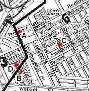
As discussed above the Phillips families began living in the center of Pittsburgh and then migrated to the Carrick area. James (1) Phillips first lived on Fourth Street in the West Ward of Pittsburgh before moving to Baldwin in the late 1820s. As noted above John Phillips left his family home sometime after the Pittsburgh fire in 1845 when he married Eliza Rossiter. They settled at 33 Prospect Street (also known as Bedford Street) (Location A below) and lived there until 10 November 1853 when they bought a two story brick row house at 18 Federal Street (Location B below). James was living with John at the time of the 1860 census. They probably had the office for their construction partnership there.
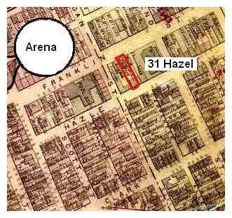
Right after the 1860 census James married Anne Provost, and they lived at 31 Hazel (Decatur) Street (right map above and Location C, left) near where John lived (Location B left below). Their sister Susannah lived at 90 Wylie Street (Location C left below) with her husband Robert Lafferty. This area now is part of the Civic Center Arena.
The first reference to the home of James (2) is in the Directory of Pittsburgh and Allegheny cities, 1864 -1865 which listed him as a bricklayer at 31 Decatur in Pittsburgh. This part of Decatur sometime after 1867 was renamed Hazel. The home was probably a two story brick row house and near an old Presbyterian Church (the 8th) between Hazel and Franklin in Ward 8. James (2) and the family lived in this house until he died there in 1882; however, they did move to other locations due to his construction work. They lived in Indiana Township near the Etna area around 1870 when he built the Allegheny County Workhouse at Blawnox, near Pittsburgh beginning in about 1868. After the death of James in 1882, Annie and her family moved to Brownsville Road area near where James (1) had lived.
Pittsburgh Locations for John, James and Susannah Phillips
(Wards 3 and 6 in 1827)
The Home of James (2) Phillips
From the information in various deeds, John Phillips moved from Pittsburgh to the Baldwin area in 1866 between April and October and appears to have lived with his father to help take care of him. His father died in November, and since the property of his father was sold in October 1869, John relocated to Birmingham to 621 Cason Street [“The 1877 - 1878 Directory of Pittsburgh and Allegheny Cities”] where he also appears in the 1870 census. An 1872 map showed that this property was owned by J. H. Swett; so John was probably renting. On 28 December 1867 John bought 16 acres across Brownsville Road from where his father had lived from Rev. James Kirk, but did not move there until after the 1870 census.
St. Clair (Carrick) Properties
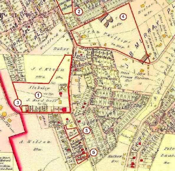
James (1) Phillips in 1828 bought property in St. Clair Township which became Baldwin Township in 1844 and was later incorporated into the city of Pittsburgh as Carrick. He and the family had moved there by 1830 since the census of that year shows him to be in St. Clair. It also was not far from where Elizabeth’s parents had lived further out Brownsville Road in Baldwin; however, they both had died by 1830. His home and blacksmith business was close to Brownsville Road and the rest was reported to be a farm. It also had a good supply of coal which James required for his business. The 1905 map below shows the location of this property and others that were owned by members of the Phillips family. It also locates the office of Dr. James Duff and the Concord Presbyterian Church.
The Property No. 1 on the map to the left is the location of the land that James (1) Phillips bought in St. Clair Township based on property deed information. He purchased this property from Margaret Allison on 31 March 1828, but later readjusted its northern border with John Brawley on 23 May 1839. The property was located on Brownsville Road near Becks Run Road.
Early St. Clair (Carrick) Properties
James (1) Phillips died intestate in 1886, and the court papers show that his property was divided into three parts. However, the heirs could not decide on the disposition of the homestead, and the Orphan’s Court directed the Sheriff to review the property. He reported that it could not be further divided without losing value; so the court then ordered on 31 Aug 1867 for him to sell it in Public Auction. Susannah (Phillips) Lafferty bought the real estate for $12,507 on 28 September 1867, and John Phillips and Robert Lafferty transferred the property to her on 1 November 1867. The heirs were then paid in cash. After her husband, Robert Lafferty, tragically died in a fire on 4 August 1868, Susannah sold the property on 1 October 1869 in three parcels according to the court plan to Thomas Coffin, John C. Klein and George Baker. She reserved the coal rights for herself.
Part A (John Klein) was the main portion of the land where the family home was located. It was most likely a two story frame house with a porch across the front. There also was a stable and other buildings. These buildings probably were the blacksmith shop of James. Most family businesses were operated in near the house, even those that created a lot of smoke like his furnace. The buildings were located in the square area on the above map on the land identified as Slakeley. Part A included all the Shakeley and J Boyd Duff land. Part B (Thomas Coffin) was a thin strip of land on the east side of Brownsville Road that was cut off by its realignment. Part C (George Baker) is the triangular area to the north on the above map identified as Klein. It was an orchard when James was alive.
Property No. 2 is the location of the Concord Presbyterian Church which was the family church for many years. James and Elizabeth and two of their children are buried there. Robert and Susannah Lafferty also are buried there, but there is no record of their graves. It was founded (about 1832) shortly after James moved to the area. Property No. 3 is where the Duff family had a medical office from the late-1860s next to Phillips Park. Dr. John M. Duff took over the practice of his father there in 1876 and also was active in the Concord Church.
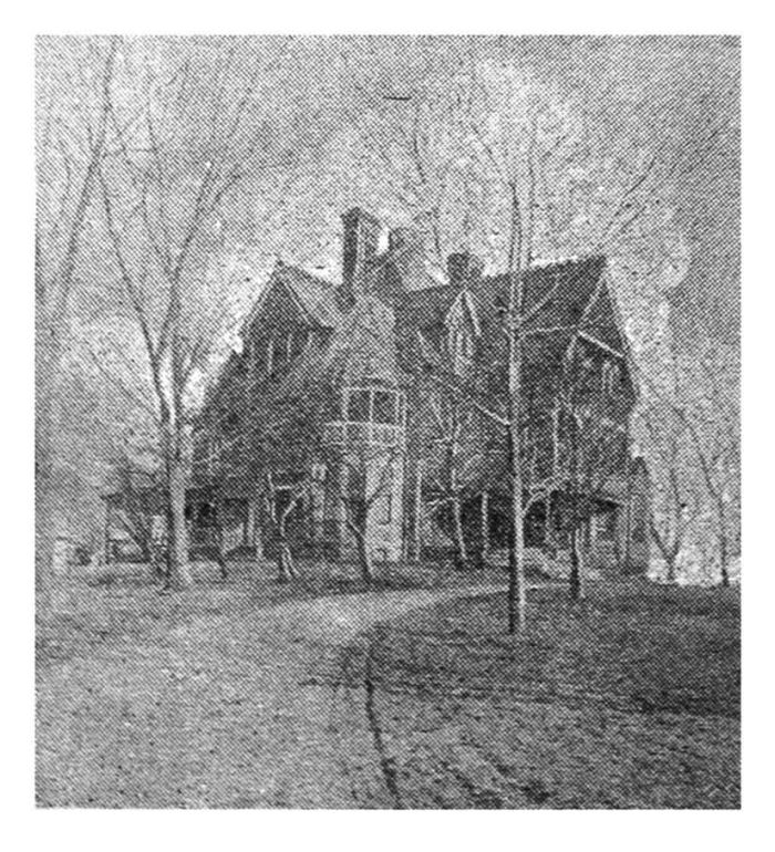
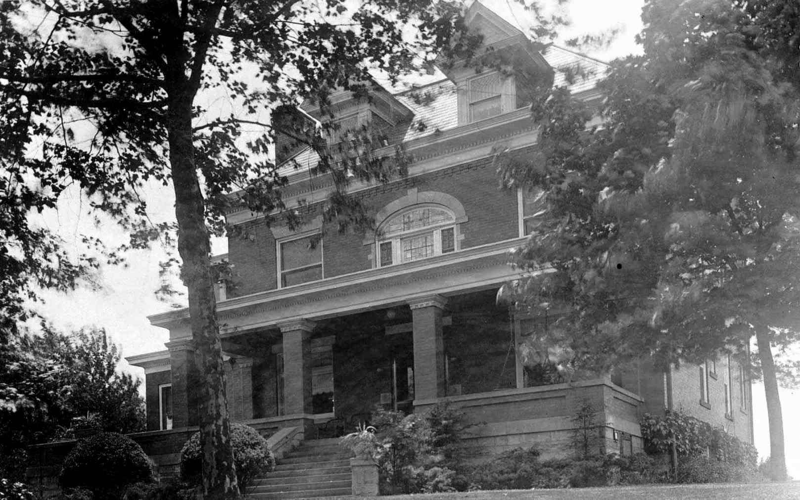
Property No. 4 was about 16 acres purchased by John Phillips on 28 December 1867 from Rev. James Kirk, who had bought it on 13 December 1866 from James B. Murray. The Rev. James Kirk was pastor of the Concord Church from 1862 to 1874, and John Phillips and his family were active in the church. After buying the property John and his family continued to live at 621 Carson Street on the South Side of Pittsburgh until after 1870. An 1876 map of Baldwin shows that John had built large home there with a circular with a circular driveway as can be seen on the map above (A picture of the house is shown to the left.), and the 1880 census lists him living there. However, the same 1880 census also shows him and his family with different ages living in Birmingham (South Side) probably at 621 Carson Street. It appears that John Phillips had kept two homes from the early-1870s into 1880s. (There also is another large estate near the Allegheny Works of the Lewis, Oliver and Phillips Company on the north side of Pittsburgh that belonged to a different John Phillips, who was part of J & H Phillips Company.)
Carrick – Brownsville Road Home of John Phillips
John died in Jan 1907, and Eliza, his wife, and their daughter, Aline, continued to live there. Eliza died in 1911, and by 1916 the property was subdivided and the house was gone. The subdivision was called Phillips Manor and the streets were named for friends of John M. Phillips, the nephew of John. Hornaday Road was named after William T. Hornaday.
Locations No. 5 and No. 6 on the above map are where John M. and Robert F. Phillips, grandsons of James (1) Phillips, owned property before they were married. Before this they were living with their parents, James (2) and Annie Phillips, in Pittsburgh at 31 Hazel Street. When their father, James (2) Phillips, died in 1882, John M. Phillips who was 21 years old bought the house on Brownsville Road (No. 5) near the Concord Presbyterian Church and the home of John Phillips. He moved his mother and the children who were still underage to this house, and Annie joined the Concord Church on 10 May 1888.
On 24 July 1899, Robert F. Phillips bought a lot (No. 6) from Anzi M. Wilson (Allegheny Deed Book Vol. 1040, page 197). It was next to his friend John J. Fleming who also worked for Phillips Mine and Mill Supply Company. On 11 August 1905 Robert bought the corner lot (No. 6) next to it from Dr. Alonso D. Husted and Emily H. Husted, his wife (Allegheny Deed Book 1392, page 476). This last one had a frame house on it, and he probably lived there until after his marriage to Bess Duff in 1909 when they bought the house at 2920 Brownsville Road in 1910. On 29 August 1922, he sold these two lots at Overbrook Boulevard to E. S. Thompson. Eventually this property became the site of the Carrick telephone exchange in the early 1930s. John M. sold his property sometime after 1905 when he moved to 2336 Brownsville Road.
The Later Carrick Brownsville Road Properties
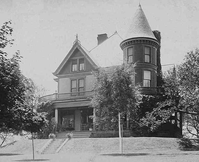
John M. Phillips in about 1905 purchased property further out Brownsville Road at 2336, and built a house there for himself and his mother (Location 1 on the map below). He remodeled and enlarged it after he married Harriet Duff Phillips in 1906 and bought the adjacent Wyland property that had a barn. The house was called “Impton” by the family because his initials (JMP) that were etched on the glass on the entrance door looked like IMP. Robert F. Phillips and his wife, Bess Harriet's sister, bought property further out Brownsville Road at 2920 (No. 2). These two homes are shown below.
2336 Brownsville Road (JMP)Home of John M. Phillips
2920 Brownsville Road (RFP) Home of Robert F. Phillips
Later Carrick Properties
Rev. James Kirk, the pastor of Concord Church, lived with his family on a farm nearby on Brownsville Road. He acquired the property (No. 3) probably about 1862 when he began his pastorate at Concord Church. An 1876 map shows that some of the frontage property had been sold. The corner piece became the site of the Spencer Lutheran Church, and its bell was the from the Kirk farm. It was rung when Jane Phillips was married at her family home at 2920 Brownsville Road in June 1941. The 1905 map shows the Pine Grove Place development that was done by William H. Kirk. He was the younger son of Rev. James Kirk. James Kirk died in 1895, but his widow, Jennie Kirk, continued to live there until about 1910 when she went to live with her daughter, Bess (Duff) Phillips at 2920 Brownsville Road. By 1916 part of the Kirk property was sold to the Mondschein family who had a butcher shop across the street from it; however a map from 1876 also shows a Mondschien family at this location. The 1916 map shows the rest of the property was transferred to James Allen Kirk who was the son of Rev. James Kirk. Eventually the Episcopal Church acquired it.
The Provost Properties
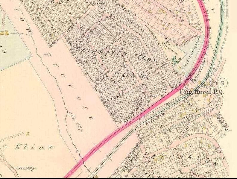
When William Provost came to the United States in 1838 he settled on a farm on Brownsville Road near where it crosses Peters Creek. The location is not furthered identified. He went back to get his family from England and after returning acquired property in the Fairview area along Saw Mill Creek (Route 88 at Fairhaven) where he engaged in farming. Subsequently he purchased the William Wilson mill on Saw-Mill Run (Route 88 at Fairhaven). When it was destroyed by fire, he bought Pollock's mill. The Fairhaven property in 1905 is shown below:
On the map below there is a flour mill on Saw Mill run next to the Fairhaven Post Office which may have been the one Watson Provost bought. One of the Streets in the Fairhaven Terrace Plan is named Phillips Avenue probably for James Phillips, his son-in-law. Further to the south is the Zion Cemetery where James and Ann (Provost) Phillips are buried along with other family members.
Provost Property on Saw Mill Run at Fairhaven
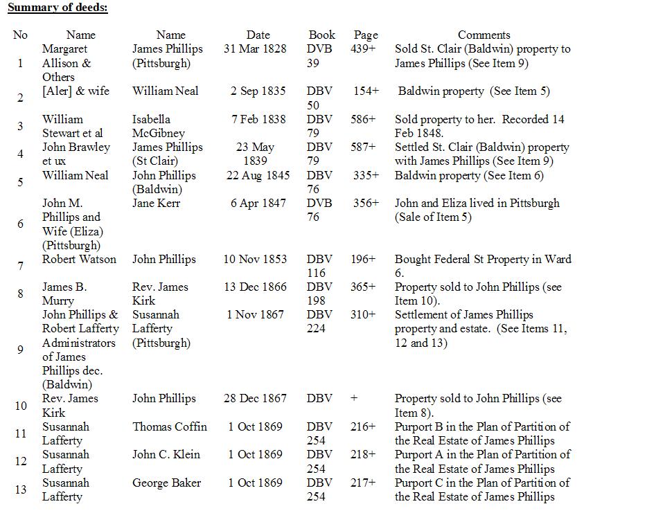
Appendix A Phillips Property Deeds
Partial Transcriptions of the deeds:
Items 1 [DBV 39, page 439+] Margaret Allison & Others to James Phillips [See Item 8]
This indenture made this first day of March in the year of our Lord one thousand eight hundred and twenty-eight. Between Margaret Allison widow, John Allison and Jane his wife, Margaret Allison, Nancy Allison and Andrew Allison widow[er] and children of William Allison late of Allegheny County and State of Pennsylvania deceased of the one part and James Phillips of the City of Pittsburgh of the other part. Wittnesseth that the said Margaret Allison, John Allison and Jane his wife, Margaret Allison, Nancy Allison and Andrew Allison for and in consideration of the sum of four hundred dollars lawful money of the United States of America unto them in hand paid by the said James Phillips at or before the sealing and delivery of these presents the receipt whereof is hereby acknowledged have granted bargained sold aliened enfeoffed released conveyed and confirmed and by these presents do grant bargain sell alien enfeoff release convey and confirm unto the said James Phillips his heirs and assigns a certain lot or piece of land situate in St. Clair township in Allegheny County aforesaid bounded as follows viz:
Beginning at a white oak thence by land late of William Fulton deceased South twenty one degrees East sixty-two perches to a stake thence by the land of John Wilson North eighty-nine and one half degrees West seventy-seven perches to a stake thence by the lands late of James Bryson North nineteen degrees West twenty-nine perches to a stake thence by the land now or late of the heirs of Nicolas Bonsman deceased South eighty-eight degrees East sixty-six perches to a stake and thence by lands late of Samuel Cowan North three degrees West thirty-one perches seven tenths to the place of beginning. Containing twelve acres three quarters and twenty-eight perches which said tract of land George [Sirton] and wife by deed dated 17th June 1811 recorded in Allegheny County aforesaid in Book R 254 conveyed to John Allison and the right and title to which hath became legally vested in said parties of the first part, together
[Standard language]
Item 2 [DBV 50, page 154+] [Aler] & Wife to William Neal
Note: This deed has not been evaluated, but provides further history on the property that John Phillips bought on 22 August 1845 (see Item 3).
Item 3 [DBV 79, page 586+] William Stewart to Isabella McGibney
NOTE: This indenture is dated in 1838, but was not recorded until 1848, ten years later. This delay may have been due to the great fire in Pittsburgh in 1845 or the settlement of the estate of John Stewart the father of William, Samuel and Sarah Stewart. The patent “Bedford” was granted to John Stewart and in trust to his brother, Robert, on 6 November 1820, but the patent was based on a Virginia Certificate dated 1787. It originally probably was part of the land of their father, John Stewart.
This indenture made the seventh day of February in the year of our Lord one thousand eight hundred and thirty eight, Between William Stewart, Samuel Stewart and Sarah Stewart of the Township of St. Clair, County of Allegheny & State of Pennsylvania of the first part and Isabella McGibney of the township, county and state aforesaid of the second part. Witnesseth that the said parties of the first part for and in consideration of the sum of one hundred an twenty dollars lawful money of the United States of America unto them well and truly paid by the party of the second part at or before the sealing and delivery of these presents the receipt whereof is hereby acknowledged have granted bargained sold aliened enfeoffed released conveyed and confirmed and by these presents do grant bargain sell alien enfoff release convey and confirm unto the said party of the second part her heirs and assigns.
All pieces of ground situate in the Township of St. Clair, county and state aforesaid, containing five acres and eight tens of a perch bounded by lands described as follows:
Beginning at a post on James McGibney’s line thence North 79 degrees West 26 perches to a post in the orchard corner of lands belonging to the heirs of John Stewart thence by lands of said Stewart heirs North eleven degrees East 30 & 2/10 perches to a post in the said heirs field thence through said field South 79 degrees East 26 perches to a post on the aforesaid land of McGibney thence along said line South 11 degrees West thirty & three tenths perches to the place of the beginning. (Being part of a tract of land called Bedford which was by Patent bearing date the sixth day of November AD 1820 entered in Patent Book N Vol. 17, page 523, conveyed to John Stewart for himself and in trust of his brother, Robert Stewart, deceased which land said John Stewart since deceased by his last will recorded in the office for recording wills in and for said County of Allegheny aforesaid willed & bequeathed unto the said parties of the first part as an reference to said records will made fully and at large appear.)
Together with .. [standard language] of the said party of the second part her heirs and assigns forever.
And Wm. Stewart, Samuel Stewart & Sarah Stewart the said parties of the first part their heirs executors and administrators grant .. [standard language]
In witness whereof the said parties of the first part have to these presents set their hands and seals dated the day and year first above written. [standard language] Sealed and delivered in the presence of us: William Stewart (seal), Samuel Stewart (seal) and Sarah (o-mark) Stewart (seal).
[Allegheny County SS] On the seventh day of February Anno Domini 1838 before me .. [standard language]
Recorded 14 February 1848
Item 4 [DBV 79, page 587+] John Brawley et ux to James Phillips [See Item 23]
This indenture made this first day of March in the year of our Lord one thousand eight hundred and thirty-nine. Between John Brawley and Mary his wife of the one part and James Phillips of the other part both of St. Clair township Allegheny county in the State of Pennsylvania. Wittnesseth that the said John Brawley and Mary his wife for and in consideration of a certain deed bearing the date this day made by James Phillips and to the said John Brawley in exchange for another piece of ground as well as the consideration of one dollar hand paid to the said John Brawley the rest whereof is hereby acknowledged have granted bargained sold aliened enfeoffed released conveyed and confirmed and by these presents do grant bargain sell alien enfeoff release convey and confirm unto the said James Phillips his heirs and assigns a certain piece of ground situate in St. Clair Township in the county and state aforesaid adjoining land of John Brawley being a piece of the same and which was conveyed to John Brawley by John Wilson, Joseph Wilson and Margaret Wilson by deed dated the Nineteenth day of December in the year 1838 (containing eighty-six perches. Beginning at a post near a young locust thence by land of James Phillips South 14 and 4/10 perches to a post in said Phillips’ orchard and Phillips and Brawley’s corner thence on John Brawley’s and Phillips line 10 ten and two tenth perches to a post on said line thence by land of John Brawley North 28 twenty-eight degrees fifteen 8/10 perches to a post in Brawley’s field and from thence North eighty-eight and ¾ East two perches to the place of the beginning. Containing the above measure eighty-six perches. Being a small piece of the same land purchased by John Wilson and Joseph Wilson purchased from Geo. [Mushauah] et ux by deed recorded in Book Q, page 439. Together with
[Standard language.]
Item 5 [DBV 76, page 335+] William Neal & Wife to John Phillips
This indenture made this twenty second day of August in the year of our Lord one thousand eight hundred and forty-five. Between William Neal and Elizabeth his wife of the first part and John Phillips of the second part all of Baldwin Township Allegheny County Penna. Wittnesseth that Wm Neal & Elizabeth his wife for and in consideration of the sum of two hundred dollars lawful money of the United States of America unto them in hand paid by the said John Phillips at or before the sealing and delivery of these presents the receipt whereof is hereby acknowledged have granted bargained sold aliened enfeoffed released conveyed and confirmed and by these presents do grant bargain sell alien enfeoff release convey and confirm unto the said John Phillips his heirs and assigns a certain lot or piece of land lying and being in Baldwin Township Allegheny County Pennsylvania bounded and described as follows:
Beginning at a distance of five hundred and forty-two and one half links from the first corner after beginning on land formerly Glass second line on a public road at a post thence South seventy nine degrees East five chains fifty-two and one half link to a post at the third corner of land formerly Glass thence by said line South nineteen degrees East three chains sixty-five and seven tenths links to a post at the distance of nine hundred forty-four and three tenths links from a Black Oak stump thence South nine degrees West five chains fifty-two and one half links to a post on the aforesaid road thence North nineteen degrees West three chains sixty-five and seven tenths links along said road to the place of the beginning. Containing two acres strict measure being the same tract of land conveyed to Wm Neal by [Aler] & wife by deed dated 2nd September 1835 & recorded in Allegheny County recorder in Book [No] C Vol 50 pages 154 c.
Together with [standard language].
Item 6 [DBV 76, page 356+] John Phillips & wife to Jane Kerr [See Item 5]
This indenture made this ninth day of April in the year of our Lord one thousand eight hundred and forty-seven. Between John M. Phillips and Eliza his wife of the City of Pittsburgh, the County of Allegheny and the State of Pennsylvania of the first part and Jane Kerr of the City of Pittsburgh, the County of Allegheny and the State of Pennsylvania of the second part. Wittnesseth that the said party of the first part for and in consideration of the sum of two hundred and seventy-five dollars lawful money of the United States of America unto them well and truly paid by the said party of the second part at or before the sealing and delivery of these presents the receipt whereof is hereby acknowledged have granted bargained sold aliened enfeoffed released conveyed and confirmed and by these presents do grant bargain sell alien enfeoff release convey and confirm unto the said party of the second part her heirs and assigns all that certain tract or piece of land situate in Baldwin Township in the County of Allegheny bounded and described as follows:
Beginning at a distance of five hundred and forty-two and one half links from the first corner after beginning on second line of land belonging to the heirs of the late Andrew S. Kerr on a public road at a post thence South seventy [nine] degrees East 5 chains fifty-two and one half link to a post at the [third] corner of said heirs land thence by said line South nineteen degrees East [three] chain sixty-five and seven tenths links to a post at the distance of nine hundred [forty]-four and three tenths links from a Black Oak stump thence [North seventy] nine degrees West five chains fifty-two and one half links to a post on the aforesaid road thence North nineteen degrees West three chains [sixty]-five and seven tenths links along said road to the place of the beginning. [Containing] two acres strict measure being the same tract of land conveyed to John M. Phillips by William Neal and Elizabeth his wife by deed dated 22nd of August 1845 and recorded in Allegheny County Pennsylvania in Book [No.] C Vol 76 page – Together with [standard language].
Item 7 [DBV 116, page 196+] Robert Watson to John Phillips
This indenture made the tenth day of November in the year of our Lord One thousand eight hundred and fifty three (AD 1853). Between Robert Watson of the City of Pittsburgh, County of Allegheny and State of Pennsylvania of the first part and John Phillips of the same place of the second part.
Witnesseth that the said parties of the first part for and in consideration of the sum of eight hundred dollars lawful money of the United States of America unto him well and truly paid by the party of the second part at or before the sealing and delivery of these presents the receipt whereof is hereby acknowledged have granted bargained sold aliened enfeoffed released conveyed and confirmed and by these presents do grant bargain sell alien enfoff release convey and confirm unto the said party of the second part his heirs and assigns.
All that certain lot or piece of ground situate in the Sixth Ward of the City of Pittsburgh aforesaid bounded and described as follows:
Beginning at a point on the western side of Federal Street at the distance of two hundred and fifty four feet and seven inches South from Wylie Street thence Southward along said Federal Street twenty feet, thence by a line Westwardly and parallel with Wylie Street ninety six feet to Union Alley thence Northwardly and parallel with Federal Street twenty feet and thence eastwardly and parallel with Wylie Street ninety six feet to the place of the beginning. (Being part of that certain piece of ground which Theophilund A Wylie and Rebeca D., his wife, and Thedrous W. Wylie and Loniea Z., his wife, by their deed bearing the date the twenty ninth day of October in the year eighteen hundred and fifty three and recorded in the Recorders Office of Allegheny County aforesaid in Deed Book Vol – page --, granted and conveyed to Robert Watson and his heirs in fee simple.
Together with all and singular the buildings improvements … [standard language].
In witness whereof the said party of the first part have to these presents set their hands and seals dated the day and year first above written. [standard language] Robert Watson (seal)
Recorded 27 November 1854
Item 8 [DBV 198, page 365+] James B. Murray et ux to Rev. James Kirk
This indenture made the thirteenth day of December in the year of our Lord one thousand eight hundred and sixty-six. Between James B. Murray and Annie S., his wife, of Allegheny County and State Of Pennsylvania the parties of the first part and Rev, James Kirk the party of the second part.
Wittnesseth that the said parties of the first part for and in consideration of the sum of six thousand two hundred and seventy-five & 58/100 dollars ($6,275.58) lawful money of the United States of America unto them well and truly paid by the said party of the second part at or before the sealing and delivery of these presents the receipt whereof is hereby acknowledged. Hath granted bargained sold aliened enfeoffed released conveyed and confirmed and by these presents do grant bargain sell alien enfeoff release convey and confirm unto the said party of the second part her heirs and assigns. All the following described lots of ground (excepting the coal therein) situate in Baldwin Township, Allegheny County and State of Pennsylvania being lots in the said J. B. Murray’s Plan of Lots in said township as laid out by P. C. Devlin, Jr. surveyor, viz:
1. That certain lot of ground marked number “One” (No. 1) in said plan and bounded by lots numbered “Two” and “Six” by Murray scheme and the Brownsville Plank Road containing one hundred and thirteen and one half perches (113 ½ Per.).
2. That certain lot of ground marked number “Two” (No. 2) in said plan and bounded by lots numbered “One”, “Six” and “Three” and the Brownsville Plank Road containing ninety-nine and three quarter perches (99 3/4 Per.).
3. That certain lot of ground marked number “Three” (No. 3) in said plan and bounded by lots numbered “Two”, “Seven” and “Four” and the Brownsville Plank Road containing ninety-eight and one half perches (98 ½ Per.).
4. That certain lot of ground marked number “Four” (No. 4) in said plan and bounded by lots numbered “Three”, “Seven” and “Five” and the Brownsville Plank Road containing ninety-seven and one half perches (97 1/2 Per.).
5. That certain lot of ground marked number “Five” (No. 5) in said plan and bounded by lots numbered “Four” and “Seven” the Six Mile Ferry Road and the Brownsville Plank Road containing ninety-seven perches (97 Per.).
6. That certain lot of ground marked number “Six” (No. 6) in said plan and bounded and described as follows to wit: Beginning on Murray scheme at the corner of Lot No. 1 and running by said scheme S 52 degrees 10 minutes E 1-90 perches, S 78 degrees 35 minutes E 15 perches, S 59 degrees 40 minutes 24 perches, S 69 degrees 10 minutes E 12 perches, S 85 degrees 20 minutes 3.50 perches to the corner of Lot number “Eight”, thence by Lot No. 8 N 19 degrees 43 minutes W 88.40 perches to the corner of Lot number 7, thence by Lot No. 7 S 55 degrees W 286 perches, S 85 ¼ degrees W 42 perches to corner of Lot No. 2 and thence by Lots number “Two” and “One” S 17 degrees 11 minutes E 11.46 perches to the place of the beginning containing six acres and one hundred and fifteen perches (6 A 115 Per.).
7. That certain lot of ground marked number “Seven” (No. 7) in said plan and bounded and described as follows to wit: Beginning on Six Mile Ferry Road at the corner of Lot No. 5 and running thence by Lots Nos. 5, 4 and 3 S 17 degrees 11 minutes E 17.19 perches to the corner of Lot No. 6, thence by Lot No. 6 N 85 ¼ E[7/10] perches, thence N 55 degrees E 2.86 perches to corner of Lot No. 9, thence by Lot No. 9 N19 degrees 43 minutes W 85.60 perches to the Six Mile Ferry Road and thence by same S 68 ½ W 36 perches to the place of the beginning containing six acres and forty-two perches (6 A 42 Per.).
8. That certain lot of ground marked number “Nine” (No. 9) in said plan and bounded and described as follows to wit: Beginning on Six Mile Ferry Road at the corner of Lot No. 7 S 19 degrees 43 minutes E 28.60 perches to corner of Lot No. 8, thence by Lot no. 8 N 55 degrees E 30.24 perches to the corner of Lot No. 10, thence by Lot. No. 10 N 38 degrees 50 minutes W 22.70 perches to the Six Mile Ferry Road and thence by same S 68 ½ degrees W 21.20 perches to the place of the beginning containing four acres and nineteen perches (4 A 19 Per.).
9. That certain lot of ground marked number “Ten” (No. 10) in said plan and bounded and described as follows to wit: Beginning on Six Mile Ferry Road at the corner of Lot No. 9 and running along Lot No. 9 S 37 degrees 50 minutes E 27.60 perches to corner of Lot No. 6, thence by same N 55 degrees E 8.50 perches to Lot No. 11, thence by same N 37 degrees 50 minutes W 22.50 perches to the Six Mile Ferry Road and thence by same S 68 ½ degrees W 9.70 perches to the place of the beginning containing one acre and eight perches (1 A 8 Per.).
10. That certain lot of ground marked number “Eleven” (No. 11) in said plan and bounded by lots numbered “Eight” and “Ten” the Six Mile Ferry Road and Stevenson Street containing one an one half acres (1 ½ A.).
Saving and excepting nevertheless therefrom and thereout and from this grant and conveyance all the coal in said described and granted lots of ground.
Together with all … [standard language].
To have and to hold the said described lots numbered “One”, “Two”, “Three”, “Four”, “Five”, “Six”, “Seven”, “Nine”, “Ten” and “Eleven” in said plan … [standard language] … forever (Excepting the coal as foresaid).
And James B. Murray for the said parties of the first part, their heirs, executors and administrators do by these present … [standard language].
Shall and will warrant and forever defend in witness whereof the said parties of the first part to these presents set their hands and seals dated the day and years first above written.
James B. Murray Annie Murray
Item 9. [DBV 224, Page 310+] John Phillips & Robert Lafferty administrators of James Phillips dec to Susannah Lafferty
This indenture made the first day of November AD 1867 between John Phillips and Robert Lafferty administrators of James Phillips late of Baldwin Township Allegheny county Pennsylvania deceased of the first part and Susannah Lafferty of the City of Pittsburgh of the second part. Whereas the petition of John Phillips eldest son and heir at law of said James Phillips deceased was presented to the Orphan’s Court of said county setting forth that since James Phillips on or about the 27th day of November 1866 intestate seized in fee of [……] after [ ] real estate and praying the court to […..] to make partition of the real estate of the said intestate in the said petition mentioned to and among his children and representatives whereupon on the 6th day of April 1867 an inquisition was [ ] by the court [ ] a visit of partition or validation issue out of the said court to the sheriff of said county […] him to [….] partition of the said real estate returnable to the next term [ ] Whereas the said sheriff made [ ] of the said [ ] with a schedule [ ] under the hand and seal as well of the said sheriff and of the inquest therein [ ] whereby is [ ] by the [..] of the said inquest [ ] the real estate in said [….] could not be equally parted and divided […] among the said parties therein [ ]
On the 28th day of September 1867 [..] to sale by public auction and sold the same to said Susannah Lafferty for the sum of twelve thousand five hundred and seven dollars ($12,507) she being the highest bidder and then the highest and best price bidder for the same which sale or return thereof made to the said court was on the 26th day of October 1867 confirmed and it was ordered and [ ] by the said court that the premises so sold [… ] to the said Susannah Lafferty her heirs and assigns
The administrators should execute and deliver […] for the same to the said Susannah Lafferty in her compliance with the terms of the sale as by the records of the said court in {part….} at to 3 March [Levin] 1867will [..] fully appear [..] this […] Witnessth [..] the said John Phillips and Robert Lafferty administrators as aforesaid for and in consideration of the sum of twelve thousand five hundred and seven dollars ($12,507) paid or secure to be paid as directed by the said order of court at and before the sealing an delivery hereof the receipt is hereby acknowledged have granted --- etc. ---- by these present & by [..] of the persons and authorities to them given by the aforesaid {..} Orphans’ Court
All that certain tract of land situate in Baldwin Township, Allegheny County, Pennsylvania bounded and described as follows, to wit:
Beginning at a post on Brownsville Road thence by lands of James Hays S 18 33 E 45 4/10 perches to a post, thence by lands of McFadden and John Wilson N 87 36 W 77 perches to a post, thence by the land of McKee N17 21W 29 perches to a post, thence by the land of John Clanuey S 87 21 E 56 62/100 perches to a post, thence by the land of John Claskey N 29 40 E 15 44/100 perches to a post, thence N 79 ¼ E 7 2/100 perches to the place of the beginning containing 14 acres 34 perches more or less including [..] No. 1, 2 and 3 being part of the same which Margaret Allison and others conveyed earlier to James Phillips by deed dated 31 March 1828, recorded in Deed Book Vol. 39, page 439, together with a [..] piece of land [..] by John Brawley to said James Phillips by deed dated 23 May 1839 recorded in Will Book Vol. 79, page 587.
[standard language]
Recorded 22 November 1867
Item 10 [DBV 254, page 216+] Kirk to John Phillips
Item 11 [DBV 254, page 216+] Susannah Lafferty to Thomas Coffin
This indenture made the first day of October in the year of our Lord one thousand eight hundred and sixty-nine. Between Susannah Lafferty of the City of Pittsburgh, widow of the first part and Thomas Lafferty of the second part.
Wittnesseth that the said party of the first part for and in consideration of the sum of one thousand five hundred and forty-five dollars lawful money of the United States of America unto her well and truly paid by the said party of the second part at or before the sealing and delivery of these presents the receipt whereof is hereby acknowledged. Hath granted bargained sold aliened enfeoffed released conveyed and confirmed and by these presents do grant bargain sell alien enfeoff release convey and confirm unto the said party of the second part her heirs and assigns. All that certain tract or piece of land situate in Baldwin Township, Allegheny County, Pennsylvania bounded and described as follows:
Beginning at the center of Birmingham and Brownsville Plank Road, thence South 87 degrees 21 minutes East seventy-nine hundredths of a perch (79/100 Per) to a point in said road on the original line, thence South 18 degrees 33 minutes East twenty-eight 92/100 perches (28 92/100 Per) to a post, thence by land of McFadden North 87 degrees 36 minutes West fourteen 14/100 perches (14 14/100 Per) to a post in the center of said Plank Road, thence along the center of the same and line of Purport A in partition North 8 degrees 51 minutes East twenty-seven 10/100 perches (27 10/100 Per) to the place of the beginning containing one acre and forty-one perches (1 A, 41 P). Being Purport B in the Plan of Partition of the Real Estate of James Phillips, deceased, on file at No. 3 March Term 1867 and a part of the same land which the administrators of James Phillips, deceased, sold and conveyed by order of the Orphans’ Court in said partition to the said Susannah Lafferty by deed dated November 1, 1867 and recorded in Deed Book Vol. 224, page 310 excepting and reserving however thereout and therefrom all coal contained in said tract of land with right of way through the coal strata forever, for taking out or through the same the coal in this way and any other lands as any time which the coal and right of way are hereby reserved to the said Susannah Lafferty her heirs and assigns forever.
Together with all and singular the buildings improvements … [standard language].
To have and to hold the said lot of land excepting the coal and right of way therein as foresaid … [standard language].
In witness thereof the said party of the first part hath to these presents set her hand and seal dated the day and year first above written.
Susannah Lafferty
Recorded 23 April 1870
Item 12 [DBV 254, page 218+] Susannah Lafferty to John C. Klein
This indenture made the first day of October in the year of our Lord one thousand eight hundred and sixty-nine. Between Susannah Lafferty of the City of Pittsburgh, widow of the first part and John C. Klein of Lower St. Clair Township, Allegheny County of the second part.
Wittnesseth that the said party of the first part for and in consideration of the sum of six thousand four hundred and twenty-seven 25/100 dollars lawful money of the United States of America unto her well and truly paid by the said party of the second part at or before the sealing and delivery of these presents the receipt whereof is hereby acknowledged. Hath granted bargained sold aliened enfeoffed released conveyed and confirmed and by these presents do grant bargain sell alien enfeoff release convey and confirm unto the said party of the second part her heirs and assigns. All that certain tract or piece of land situate in Baldwin Township, Allegheny County, Pennsylvania bounded and described as follows:
Beginning at the centre of the Birmingham and Brownsville Plank Road, thence by the centre of said road South 8 degrees 51 minutes West twenty-seven and one tenth perches (27 1/10 Per) to a past, thence by the lands of Baker and P. S. Pollock North 87 degrees 36 minutes West sixty-two and eighty-six hundredths perches (62 86/100 Per) to a post, hence by the land of McCully North 17 degrees 21 minutes West twenty-nine perches (29 Per) to a post, thence by the land of McCully and D. Pollock and Purport C in the Partition of the Real Estate of James Phillips, deceased, South 88 degrees 21 minutes East seventy-five 63/100 perches (75 63/100 Per) to the place of the beginning, containing eleven acres and one hundred and twenty perches (11 A, 120 P) whereon is erected a frame dwelling house, stable and other improvements.
Being Purport A in the plan of Partition aforesaid on file at No. 3 March Term 1867 and a part of the same land which the administrators of James Phillips, deceased, sold and conveyed by order of the Orphans’ Court in said partition to the said Susannah Lafferty by deed dated November 1, 1867 and recorded in Deed Book Vol. 224, page 310 excepting and reserving however thereout and therefrom all coal contained in said tract of land with right of way through the coal strata forever, for taking out or through the same the coal in this way and any other lands as any time which the coal and right of way are hereby reserved to the said Susannah Lafferty her heirs and assigns forever.
Together with all and singular the buildings improvements … [standard language].
To have and to hold the said lot of land excepting the coal and right of way therein as foresaid … [standard language].
In witness thereof the said party of the first part hath to these presents set her hand and seal dated the day and year first above written.
Susannah Lafferty
Recorded 23 April 1870
Item 13 [DBV 254, page 220+] Susannah Lafferty to George Baker
This indenture made the first day of October in the year of our Lord one thousand eight hundred and sixty-nine. Between Susannah Lafferty of the City of Pittsburgh, widow of the first part and George Baker of the second part.
Wittnesseth that the said party of the first part for and in consideration of the sum of one thousand and seven 29/100 dollars lawful money of the United States of America unto her well and truly paid by the said party of the second part at or before the sealing and delivery of these presents the receipt whereof is hereby acknowledged. Hath granted bargained sold aliened enfeoffed released conveyed and confirmed and by these presents do grant bargain sell alien enfeoff release convey and confirm unto the said party of the second part her heirs and assigns. All that certain tract or piece of land situate in Baldwin Township, Allegheny County, Pennsylvania bounded and described as follows:
Beginning at a point in the Birmingham and Brownsville Plank Road, thence by Purport A in the Plan of Partition of the Real Estate of James Phillips, deceased, North 87 degrees 21 minutes West nineteen 8/10 perches (19 8/10 Per) to a post, thence by the land of Baker North 29 degrees 40 minutes East fifteen 44/100 perches (15 44/100 Per) to a post, thence North 79 ¼ degrees East 7 02/100 perches to a post, thence South 18 degrees 33 minutes East 16 48/100 perches to the place of the beginning, containing one acre and thirty-three perches (1 A, 33 P).
Being Purport C in the plan of Partition aforesaid on file at No. 3 March Term 1867 and a part of the same land which the administrators of James Phillips, deceased, sold and conveyed by order of the Orphans’ Court in said partition to the said Susannah Lafferty by deed dated November 1, 1867 and recorded in Deed Book Vol. 224, page 310 excepting and reserving however thereout and therefrom all coal contained in said tract of land with right of way through the coal strata forever, for taking out or through the same the coal in this way and any other lands as any time which the coal and right of way are hereby reserved to the said Susannah Lafferty her heirs and assigns forever.
Together with all and singular the improvements … [standard language].
To have and to hold the said lot of land excepting the coal and right of way therein as foresaid … [standard language].
In witness thereof the said party of the first part hath to these presents set her hand and seal dated the day and year first above written.
Susannah Lafferty
Recorded 23 April 1870
